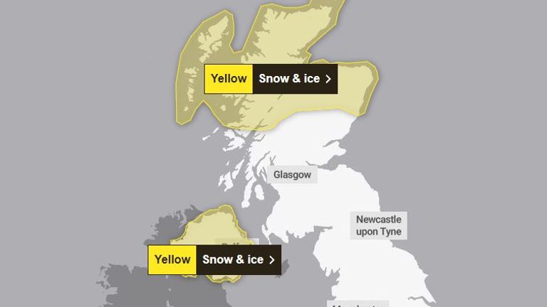
Snow is set to hit parts of Scotland today before spreading south next week as cold air from the Arctic brings freezing temperatures.
Up to 5cm of snow is expected in places by the end of Sunday, causing disruption on the roads and railways.
A yellow weather warning for snow and ice is in place into Monday, covering areas including the Highlands and the Orkney and Shetland Islands.
The Met Office says parts of northern Scotland could see around 10cm of snow over the two days.
Northern Ireland could also see up to 5cm of snow on higher ground on Monday, with a yellow warning in place from 3am until the end of the day.
A yellow cold-health alert remains for the North East of England, Yorkshire and the Humber, East of England, South East of England and London for much of the incoming week.
Check the five-day forecast where you are
Forecasters predict the snow will then move south over the course of the week, with the potential for wintry weather in parts of northern England on Tuesday.
Southern regions were said to be at “low risk” of snow.
Read more:
Why forecasting snow in the UK is a big challenge
Adam Boulton: Post Office hero should refuse a ‘tainted’ honour
Met Office meteorologist Honor Criswick said: “It is going to be feeling pretty chilly in the north of Scotland.
“Throughout the week we are going to see more and more snow showers and warnings, towards the end of the week we will probably see an accumulation.
“The warning is of 2cm to 5cm of snow, throughout the week there is the possibility we will see a build-up of snow.
“On Tuesday, we are going to see more rain turning to snow moving east across the country, with more prolonged snow and more accumulations at low levels in the north of Scotland and northern England.
“That’s where we could see 5cm or 10cm of snow in low-lying areas.
“There’s a very low chance the south might see a bit of it.”
Earlier this month, Storm Henk caused widespread flooding and two deaths, and more than 170 flood warnings remain in place.
